


Forest Park Offline Trail Map, Portland, Oregon
Featured in Portland Monthly Magazine!
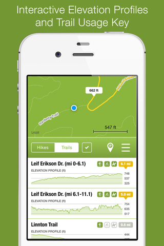
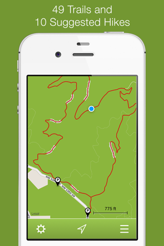
Offline map and trail guide for Forest Park in Portland, Oregon. Fully interactive map complete with trails, suggested hikes, GPS location, and elevation profiles.
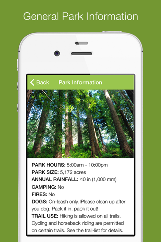
Just west of downtown Portland, Forest Park is one of the countrys largest urban forest reserves, and is a major component of a regional system of parks and trails. Covering more than 5,100 acres, the park includes over 70 miles of recreational trails, making it an excellent place for walking, running, hiking, biking, and horseback riding.
Although Forest Park is within walking distance of Northwest Portland, it’s notorious for its lack of network coverage. Our Forest Park app solves this problem! Once the map is downloaded, you’re free to explore the entire park without a network connection.
FEATURES:
• Simple, easy-to-use interface.
• Fully interactive offline map.
• GPS location shown on map.
• Navigate the park in its entirety.
• 49 trails and 10 suggested hikes.
• Interactive elevation profiles.
• Trail and Hike lengths.
• Trail-usage key for hikers, bikers, and horses.
• Parking locations shown on map.
• General park information.
The Forest Park app is designed for the iPhone. Although it can be installed on GPS-enabled iPads (iPads with Wi-Fi + Cellular), it’s not formatted for the larger iPad screen - it runs doubled like all other iPhone apps.
The offline-map is an additional (free) 50 MB download after the app is installed. A fast network connection (Wi-Fi, LTE, 4G) is recommended. Standard cellular data rates apply if the map is downloaded over a cellular connection.
Proudly made in Oregon by Scott D. Smith and Paul Burd. We sincerely hope you like it!